 EN
EN IT
IT DE
DE FR
FR PL
PL NL
NLFarmhouse Podere il Pino surroundings: Chianti
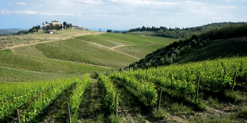 Chianti's hills pass through the marvellous tuscan landscape, connecting the provinces of Siena and Arezzo to the area of Valdarno and Val di Pesa. Many of the towns of this area, are the place of production of the most famous and special Chianti wine, red wine DOCG. The towns which are part of the Chianti area are: Greve in Chianti (Montefioralle), San Casciano in Val di Pesa (Faltignano,Campoli, Montefiridolfi), Radda in Chianti (Volpaia), Gaiole in Chianti (Castello di Brolio), Tavarnelle Val di Pesa (Sambuca Val di Pesa, San Donato in Poggio), Barberino Val d'Elsa (Tignano), Castelnuovo Berardenga (San Gusmè,Vagliagli), Poggibonsi. To the lovers of good wine, we recommend to admire the wonderful vineyards and to taste the typical products of those amazing places.